Living in a place with the highest number of historically active volcanoes in the world (as per USGS), most Indonesians (except for those living in Borneo and a few other islands) have for generations been accustomed to living a life attuned to the deadly cycles of those fiery mountains. When they erupt, volcanoes take lives – those of humans, animals, and plants – but the trails of destruction they leave always become perfect ground for rebirth. Soils are replenished with minerals, pioneering plants start to grow, and in a few years’ time other forms of life return. Although there are a number of volcanoes where you can see the evidence of this cycle, Mount Papandayan in Garut provides a particularly good and relatively accessible example for those who wish to see how a volcano takes and gives life.
With me at the steering wheel and James as the navigator, one Friday morning we left the comfort of our hotel for this volcano, which can get very popular on weekends. Google Maps recommended what appeared to be a pretty straightforward route to Papandayan. But in reality, it took us through towns with extremely busy markets that spilled over into the already narrow street. We had to move at a snail’s pace, but there was no other option than to keep going forward. As it also happened to be a cloudy morning, I was hoping by the time we arrived at our destination the weather would have improved.
It wasn’t until we came across a bigger road that driving became a lot easier. Motoring along at a steady speed, I kept following a few cars in front of me until we reached a point where a small village street forked out of the main artery. All I had to do was follow it and soon I realized I’d made the right decision to get my car checked before going to Garut – the mechanic had found an issue with the braking system which required a component to be replaced. Had I not done that, I would have not had the courage and confidence to keep going on this narrow road with an incline that felt increasingly steep as I drove closer to the volcano. In the last few kilometers, I even had to step on the gas pedal deeper and make the car engine work harder. It was quite tense to be honest, but as soon as we arrived at the surprisingly wide parking area and opened the car doors, we were welcomed by cold yet refreshing mountain air. We went from a little less than 800 meters to more than 2,000 meters above sea level in about one and a half hours.
After a much-needed toilet break and a touch of cold alpine water, we began our hike toward the crater. The top of the hill right in front of us was still covered in thick fog, but I remained hopeful that the weather would eventually improve. Papandayan is a stratovolcano that has erupted several times in the past few centuries. An eruption in the 18th century caused its northeastern side to collapse which resulted in a catastrophic debris avalanche that destroyed dozens of villages and killed thousands. Coincidentally, a few weeks before going to Garut I watched a documentary from National Geographic about Mount St. Helens’ massive eruption in 1980 which obliterated its northern face. Whether the circumstances around both eruptions were similar or not, I don’t know for sure. But because of the way Papandayan looks now – with its open crater visible from afar due to the collapse of one side of the volcano – I couldn’t help but think of that harrowing minute-by-minute animated reenactment of Mount St. Helens’ eruption that is made possible by current technology.
Less than ten minutes from the start of the hike, I could already see smoking fumaroles coming out of the crater. As expected, the closer we approached, the stronger I could smell sulfurous gases in the air. The white fumes rose from cracks in the ground, before merging themselves with the low clouds that were hanging above us. It was a landscape tinted in greyscale; even the green colors of the shrubs around us were muted. We took a short break near the crater to take some photos before continuing to the first of three stops on this hike.
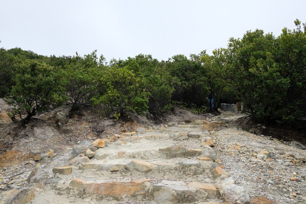
Going up to Hutan Mati, the first stop
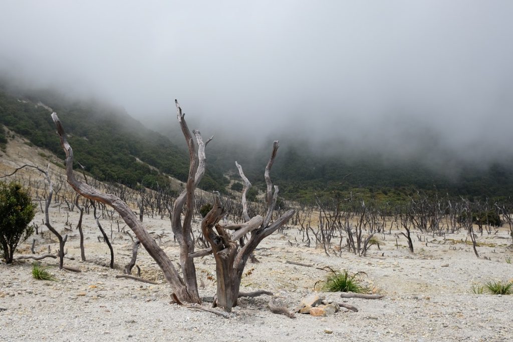
Dead tree trunks at Hutan Mati
Hutan Mati, literally ‘dead forest’, is undoubtedly Papandayan’s most iconic site. Located above the crater, it can be reached via a set of stairs specifically made to give visitors easier access to this much-photographed location. It only took us about ten minutes from the bottom of the steps to the end, but for me it felt much longer – maybe due to the elevation – as I made sure not to go up too fast especially after that frightening experience on the Cisadon Trail a month earlier. At Hutan Mati, there were only two other visitors, and because of the grim and quiet setting with hundreds of dead tree trunks dotting the landscape, suddenly the eerie soundtrack from a scene in The Lord of the Rings: The Two Towers where Gollum leads Frodo and Sam through the Dead Marshes played in my head. These dead trees are silent witnesses to Papandayan’s eruption in 2002, but almost two decades later visitors can now see how plants have started to reclaim this barren land which was once filled with vegetation.
Moments after we arrived at Hutan Mati, the clouds began to open up, allowing the sunlight to reach this highland. Then, like magic, this very landscape that felt sinister a few minutes earlier was suddenly filled with a burst of colors: green, yellow, and dark red from trees and shrubs that grow in this part of Papandayan. After taking more than enough photos at our first stop, we moved on to the second location called Pondok Saladah… only if we could find the way to go there. From Hutan Mati, it took us a while to spot the trail to our next destination as it wasn’t signposted. However, once we found it, the path became clearer and clearer, and reaching Pondok Saladah was quite straightforward. Along the way, something beautiful stole my attention. It was a plant that looked familiar yet foreign. It turned out to be the Javanese edelweiss (Anaphalis javanica), a flowering plant found mostly in some of Indonesia’s mountainous regions. Later when I had returned to Jakarta, I looked up the photos I took from Mount Rinjani in 2013, and my memories served me right. I did take a photo of the same, albeit much smaller, plant when I was waiting for sunrise at Indonesia’s second tallest volcano all by myself.
From afar, a Javanese edelweiss tree at Papandayan will likely catch your attention, for its silvery needle-like foliage with dainty yellow and white flowers are quite a contrast to its primarily green surroundings. When you put your nose close to the blooms, you’ll notice a pleasant sweet scent emanating from them. First identified in 1819 by a Dutch botanist Caspar Georg Carl Reinwardt who discovered it on the slopes of Mount Gede – one of West Java’s most prominent mountains – Javanese edelweiss is famous for its ‘eternal’ flowers that can last up to ten years. This pioneering plant is often found around a volcano’s crater where most other flora can’t grow. Unfortunately, this beautiful and unique species is currently critically endangered, which explains the relatively harsh penalty for anyone picking its flowers or causing any harm to the plant.
At Pondok Saladah, we saw an even greater number of Javanese edelweiss, and they were much bigger than the specimen we saw earlier, so much so that each individual plant seemed to outgrow one another. We walked along what I like to call the avenue of Javanese edelweisses and were the only visitors at this unlikely wonderland. Due to the abundance of fresh water and its wide open space, Pondok Saladah has become a popular camping ground. However, since we were not going to spend the night on the mountain, we had to keep moving to the third location called Ghober Hoet. As we walked along the dirt path that cuts through a dense forest, James suddenly stopped when he saw a viewpoint from which we could see the puffs from the fumaroles, the dead trees of Hutan Mati, a small waterfall, and lush green peaks all in the same frame. Thanks to his sharp eyes we got to take some shots from this seemingly less popular angle.
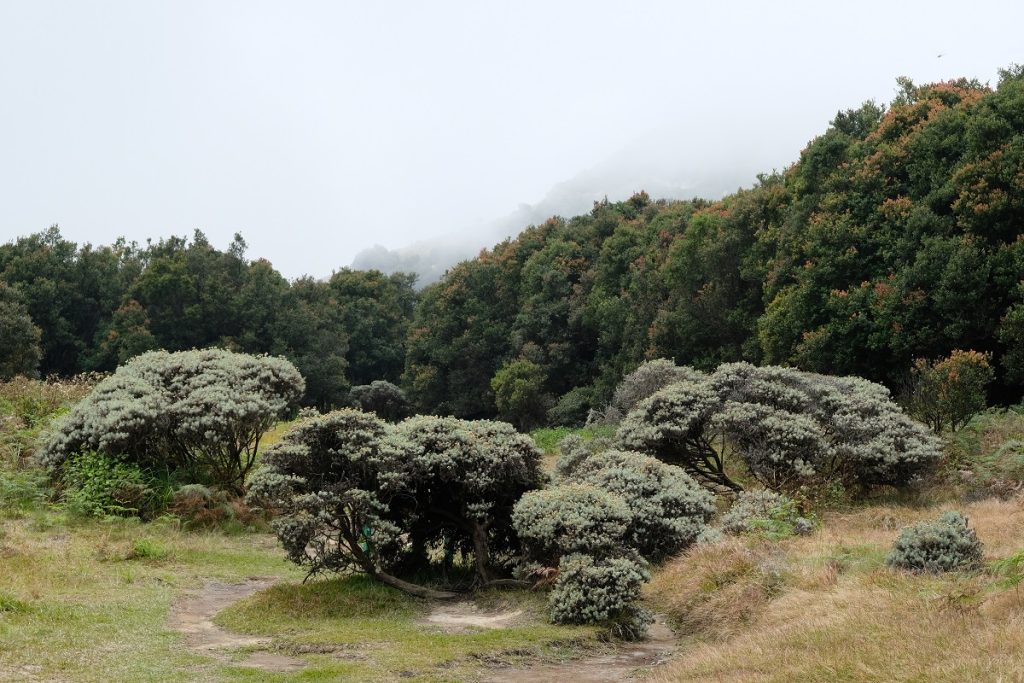
The highest concentration of Anaphalis javanica I’ve ever seen
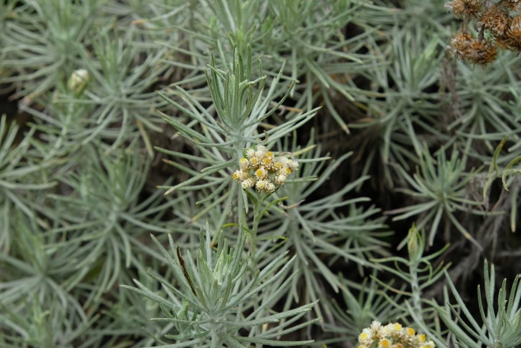
Dainty flowers with a sweet scent
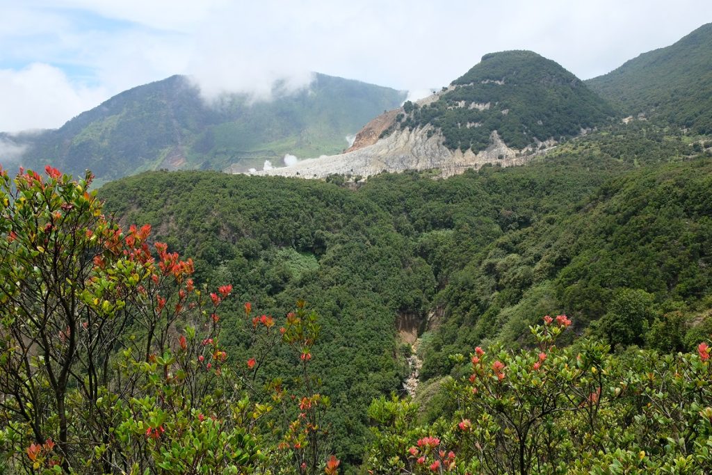
That barren patch is Hutan Mati
When we arrived at Ghober Hoet, we did see some more Javanese edelweisses, but they were nowhere as big as the ones we saw in Pondok Saladah. So, we didn’t spend too much time in the third stop and kept moving toward the point where we started the hike a few hours earlier. By this time, the clouds had mostly cleared up, leaving the hot scorching sun shining right above our heads for the rest of the hike. Prior to this trip, I read about how a lot of people consider this trail friendly for beginners. I won’t necessarily see myself as a beginner since I’ve done more challenging hikes in the past, but I wouldn’t say this hike was easy either. One must be reasonably fit to do this as there were some parts of the trail that required strong legs and a good technique. However, we did do this in the opposite direction as to how most people would – starting at Ghober Hoet and ending at Hutan Mati – and maybe doing it the other way would have been easier.
Four hours after the start of the hike, we finally reached the parking area again – we spent a considerable amount of time taking photos with me ending up having more than 1,000 images from this mountain alone. At first our plan was to drive back to town and find a place to have lunch there. But we were already starving, so we decided to just go to one of the food stalls around the parking area. I usually avoid having meals at a touristy place since the prices are often inflated for something that tastes just okay. With that in mind, I didn’t expect much from these stalls other than something that is filling. We stopped by the first stall we saw and perused the menu, which was printed on a banner hanging from its roof. I asked the lady who seemed to be the owner about nasi komplit, literally ‘complete rice’, and she explained to us that it came with fried chicken, tempeh, and tofu. James nodded in agreement and I ordered the same dish for both of us.
After about 10 minutes or so, she came out from her small kitchen at the back of the stall with our lunch. Surprisingly, everything looked very nice, and we immediately dug in after she brought us a small bowl of sambal for that extra kick. (If you’ve watched Raya and the Last Dragon you probably noticed that this separate container of chili sauce/sambal is essential in the Southeast Asian street food scene.) Oh my! Wow! I was caught off-guard and genuinely impressed with the quality of the food. Every single thing on the plate tasted ‘right’ and delicious; the chicken was well-seasoned with a Sundanese spice mix, the kemangi (Indonesian basil) so fresh, the green eggplant and sliced cucumber crunchy, the rice moist, and the sambal addictive. Of everything I ate in Garut, this surprised me the most, not because the dish itself is unique – on the contrary, it’s quite a common set meal – but rather because of how good it was. With a happy tummy, I went inside the stall to talk to the owner and pay. But this time I decided to use Sundanese (as opposed to Indonesian which I used earlier). I told her how delicious everything was – we even finished the whole container of sambal – and she was delightfully surprised by the fact that I spoke to her in her mother tongue.
A perfect meal to wrap up a nice hike. I couldn’t ask for anything better. Feeling tired yet happy and well-nourished, off we returned to the city with big smiles on our faces.
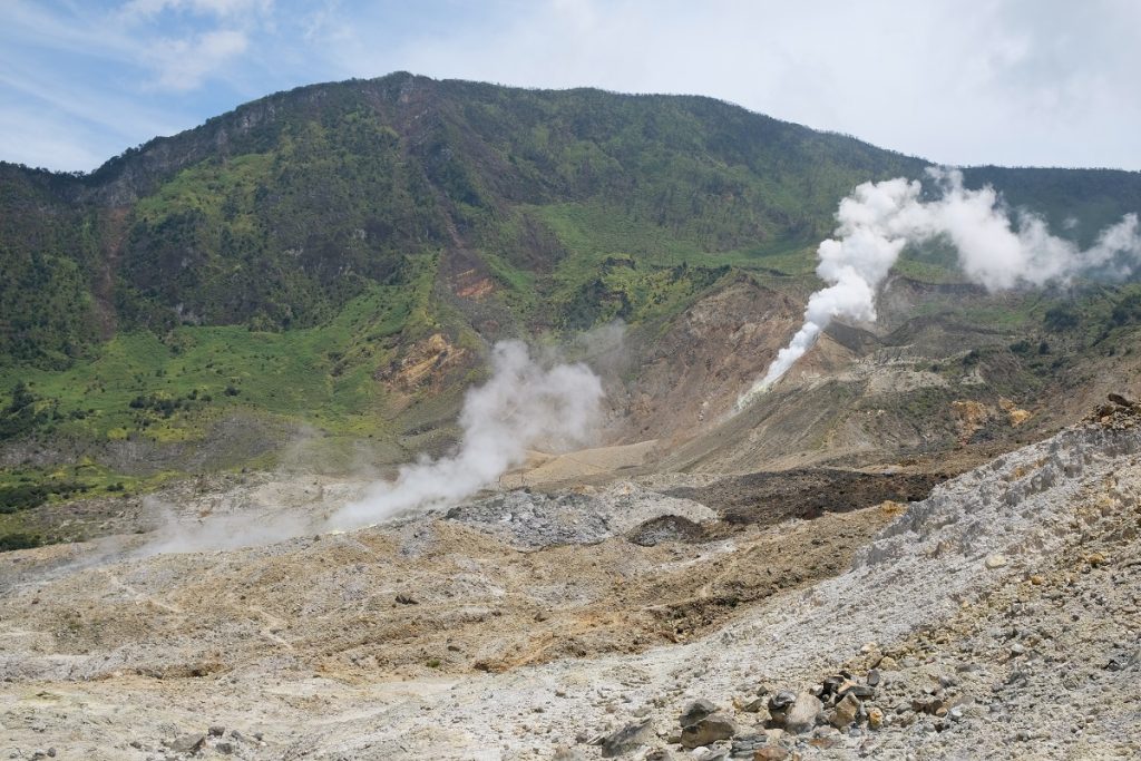
Back to the crater
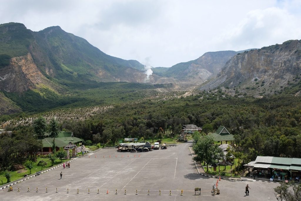
Mount Papandayan as seen from an observation tower